Wednesday 19 December 2018

My continued obsession with the abandoned rail yards of High Springs

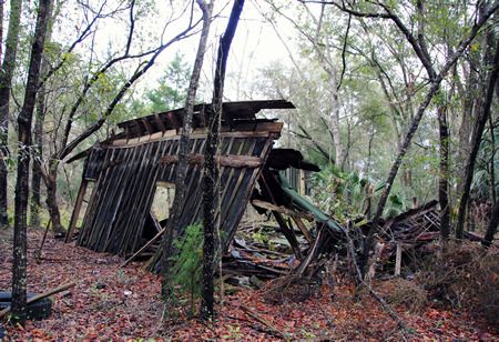
I was out for a ride on the unofficial rails-to-trails as I so often am, when I gave into temptation and decided to explore one of the paths that I've seen leading off into the woods alongside site of the old rail yards. From the rail path, they seemed to be little more than paths made by four wheelers or, sadly, people looking for somewhere out of sight to dump their trash. And while it did turn out that these paths had been used by both four wheeler riders and illegal dumpers, I was also able to explore more of the site of the former rail yards than I had before. CSX owns part of that woodland, and it hides more of the remains of the rail yards. Additionally, the well-worn paths through the tall oak woods were probably once streets through the rail yards themselves; it's quite magical. I am even more bummed that this property is not on the potential purchase list for the rails-to-trails project, as it would make such an amazing historical and natural park. First, let me provide you with some maps to orient you to the location of my most recent explorations (you may have seen similar maps previously, so feel free to scroll past), followed by my photographs. Enjoy!

The main portion of the rail yards was located in the three blue squares,
which are still owned by CSX.

This was the approximate area that I explored.

Note the wooded areas within the CSX properties

There were definitely some streets, but hardly any trees at the rail yards' demise.


Such an inviting path


I got a little spooked here... It was just a couple of deer, though.


Would be lovelier without the tire and other debris >:(


Old roads through the woods are magical!


Where do you park your ghost train?


More magical old roads


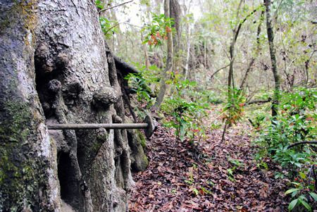
Some kind of old well top


Close-up of the old well pipe


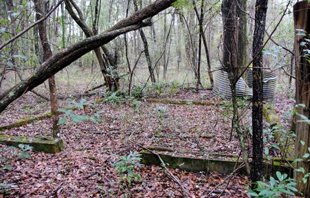
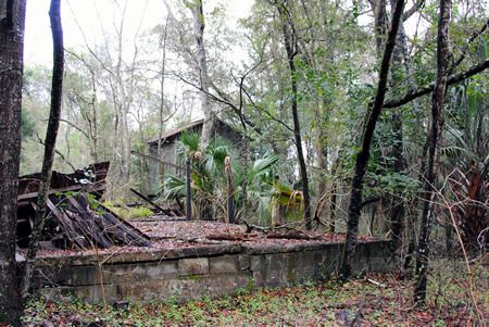
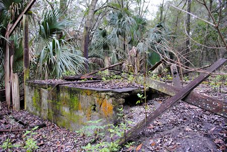
Foundation remnants


More foundations

Thursday 13 December 2018

History of High Springs

One of the springs in the area – sadly, no longer flowing at more than a trickle – was located at the top of a hill, and this is what gave the town of High Springs its current name (I wrote about the spring and its current situation here), although the town wasn’t officially named High Springs until 1892. Prior to that, non-Native settlements in this area apparently went by a variety of names, including Santaffey (Santa Fe), Fairmount, and Orion. High Springs of today is known for its antique shops, restaurants, and unique natural environment filled with rivers, springs, and forests, leading to its motto of “Enjoy our Good Nature.” However, in days gone by, while the environment played an important role in providing natural resources to the town, the railroad was the true lifeblood of the community.

In the late 1800s, High Springs went through a boom period. Discovery of phosphate in the area, the extensive availability of pine and cypress to be logged, and its location along two planned railroad routes made it an important nexus for the railroad industry. The Savannah, Florida, and Western Railroad line was the first of many railroad companies to arrive in High Springs in 1884, although the most important was the arrival of the Plant System. The Plant System settled upon High Springs as the location for its district headquarters in 1895, and began construction of a roundhouse, offices, telegraph station, two-story district hospital and more. High Springs became the center of steam rail for north central Florida. Unfortunately for High Springs, by the mid-1940s, diesel was the new power on the rails, and the High Springs rail yards – designed for steam engine maintenance – slowly dwindled. By the end of the twentieth century, as rail traffic in general declined, the rail yards of High Springs faded into the brush. The rails were finally removed in February 2015. The following pictures were all taken in High Springs.


Atlantic Coast Line Railroad Company Engine No. 801 in 190~ (source)


Main Street, High Springs, 190~ (source)


Man identified as Gus Anderson, 19~ (source)


Railroad depot, 190~ (source)


Willards' General Merchandise Store, 191~ (source)


Downtown High Springs 1916 (source)


No identifying data (source)

Downtown High Springs in the 191~ (source)


Woman identified as Edna Johns Miller, 1916 (source)

Local children, 1916 (source)


Row of workers' homes, 1916 (source)


Coal Locomotive Engine, 1948 (source)

Both images show aerial views of the High Springs rail yards, including the roundhouse in the upper left quadrant, in 1949 and 1955. You can see how the roundhouse and rail yards have deteriorated in just that short period of time. (Sources here and here)

For more information, check out the full text of the Architectural and Historical Survey of High Springs published in 1990. To take a look at my explorations of the abandoned railroad of High Springs, click here, here, and here. Lastly, my exploration of the old spring that gave High Springs its name can be viewed here.

Tuesday 11 December 2018

Fall Paddles on the Santa Fe River

The Santa Fe River runs across the northern border of High Springs. It’s also nearly entirely undeveloped, filled with springs, and an excellent river for paddling and diving year-round (although I freely admit that I prefer it to be at least 65F for paddling adventures; I like to be warm). Currently there are two excellent facilities here in/near High Springs that will rent you a boat and/or shuttle you back to your car: Rum 138 and Santa Fe Canoe Outpost. Last Saturday was possibly the last warm, sunny weekend for a while, and as my new kayak had just arrived the day before (and miraculously fit inside my tiny hatchback), I decided to take it on its maiden voyage. I decided to paddle from Rum Island to the Hwy 47 bridge – a trip I’ve done quite a few times, but never at this time of year – using the excellent shuttle services of Rum 138. Fall foliage on the Santa Fe is lovely, and I’m glad I went out even if it wasn’t quite up to my preferred level of warmth.

It was a lazy day.


Naked Springs Run


Blue Springs Run


Ginnie Springs is only this empty at this time of year!


Ginnie Springs


I snagged this map from OurSantaFeRiver.org; it shows the route I took.

Tuesday 27 November 2018

High Springs-Newberry Rail-to-Trail Update

I’ve heard back from the Alachua County Senior Transportation Planner regarding the Rails-to-Trails project connecting High Springs and Newberry. The good news is that the project is still on, it’s just been delayed:

It has indeed been a long road. Our original closing date was scheduled for December 2017. This was rescheduled to March 2018, then December 2018. Each of these extensions was agreed to in order to continue to work with CSX on an appropriate Soil Management and Capping Plan that will ensure the public can safely use the rail corridor for a trail once the County has acquired the property.

We have, most recently, entered into an agreement to extend closing to January 2019, but will likely have one more extension through June to ensure that we have all our ducks in a row. We are continuing to work with CSX and the Trust for Public Land on this project.

I wrote back and asked if the purchase would include the remains of the historic High Springs rail yards and was told that no, the purchase would only include the rail corridor proper, not the rail yards. This, as you might imagine, was a combination of both good news and bad news.

I checked the property appraiser’s website and confirmed that CSX does still own most of the rail yard land (blue). Oddly enough, according to the Alachua County Property Appraiser's website, the green land belongs to the State of Florida through the Internal Improvement Fund passed in 1855 “to oversee the management, sale, and development of public lands granted to the State through various Congressional acts. Among the internal improvements arranged through this agency were construction of canals, railroads, and land drainage and reclamation. The address provided by the property appraiser for this property is the State of Florida Department of Environmental Protection.


Blue: CSX; Green: State of Florida

The land roughly encircled in red belongs to the State of Florida.

That’s exciting! It indicates that the green land has a strong possibility of remaining undeveloped. Perhaps, if the county is unable or unwilling to purchase the non-corridor land, perhaps the state would? I would love to see this area remain wild and undeveloped. It would be great if we could somehow turn the former rail yard property into a historical park, either belonging to the state or the city – and once the bike trail goes in (although goodness knows when that project will actually be finished), it would be a great place to picnic, relax, and enjoy nature right alongside the trail.

Friday 23 November 2018

Unofficial Rail-To-Trail (for now)

So, allegedly, one of these days there is going to be a paved bike trail on the former CSX rail line between High Springs and Newberry one of these days. (I say allegedly as there may have been a hiccup; I'm waiting for the Alachua County government to get back to me.) Even without any hiccups, it could take years to start, much less finish, this project. I'm recovering from a fractured foot, which limits the amount of walking that I can do. My physical therapist recommended cycling to keep my leg muscles active, but as riding along roads scares the crap out of me, I decided to check out the former rail beds (which I blogged about herehere, and here) for the purposes of cycling. I've found a lovely route, just shy of six miles as a loop, and I've been riding it regularly for the past six months. It's a wonderful place to get your exercise, enjoy nature (lots of birds, butterflies, wildflowers, deer, etc), and not have to worry about dodging traffic.


My route ends at the remains of the old railroad bridge over the Santa Fe


Unfortunately, this is the only stretch of the former railroad that is rideable at the moment (at least to me). The track that heads north towards Prime Conduit is completely overgrown. There's definitely potential for the ballast (the gravel that supports the rails and the ties) to be worn down to a rideable level headed westward towards Newberry, as people are definitely driving on the former rail bed, but it's just not ready for the casual cyclist yet. The ballast is still too much in evidence if you head west from Poe Springs Road in the direction of Newberry. I made it about a quarter of a mile in that direction before deciding that while aesthetically it looked lovely, it just was not a pleasant ride.

Nope, not going to ride that.


So... what's up with this official bike route? Well, the last I'd heard was this bit of good news from August 2017:

Bicyclists may soon be able to pedal all around Alachua County with ease. County commissioners agreed Tuesday to spend $3.3 million to acquire land needed for a $12 million rail-to-trail project that will run from the edge of Newberry to downtown High Springs. The trail could eventually connect to other trails throughout Alachua County, creating ease for riders to tour the county.

“The (trail) network in and adjacent to Alachua County will make this an international tourist destination,” County Commissioner Robert Hutchinson said. The county will use its share of Wild Spaces and Public Places funds for the recreation project. The city of High Springs will contribute about $300,000 toward the purchase.

The 13-mile strip, which runs parallel to U.S. Highway 41, will cost at least another $8 to $9 million to pave, county spokesman Mark Sexton said. Sexton said the county will pursue grants to pay for much of the paving. Documents show the county is buying the land from the Trust for Public Land. Sexton said the project has been high on the county’s wish list for several years and that county officials have tried unsuccessfully to get state funding for the project. [complete article]

According to this article from December 2015, "the rail corridor runs next to US 27/41 from a spot near the Santa Fe River in High Springs south to just north of Newberry."

I'm not sure how much (hopefully all?) of "my" route is included in this, although I'd like to think that by "a spot near the Santa Fe River" they do actually plan to include "my" route. But then there's that hiccup I had mentioned.

Oh, goody. 

I've searched for updates. I couldn't find anything about a decision one way or the other in March 2018. I've reached out to the Alachua County government and am awaiting an answer. There is nothing about this on the City of High Springs website, but the City of Newberry's website, I learned that the November 15, 2018 City Commission meeting involved a discussion of including "Funding for the rails to trails project including High Springs to Newberry, Newberry to Trenton, and a trailhead project" (source), although I've no idea what the results of said discussion were.

I'll update you if I learn anything more.

The Original High Springs

(This was originally published on DesolationFlorida.com on January 8, 2016.)

When I was looking at real estate in and around High Springs (where I did, eventually, purchase a home back in 2014), I remember having a conversation with my mother in which we mused about the reason why High Springs was named High Springs. We thought the name was a bit odd, as it wasn’t as if there were a spring in the center of town or anything. However, we decided that perhaps the name probably came from the high quantity of springs in the near vicinity of the town; Poe, Gilchrist Blue, Ginnie, and Rum Island springs are all short drives from High Springs, and many other springs are accessible via the nearby Santa Fe River. This is apparently the etymology of the town’s name that many people in North Florida believe, although it turns out that it is not, in fact, correct.

While doing research for my various High Springs railroad posts, I had learned that there had indeed once been a spring in High Springs proper. According to the Architectural and Historical Survey of High Springs, Florida, published in 1990, “The spring that gives High Springs its name is located a mile northeast of the current center of town, in what is now a pleasant residential suburb. Its steady flow of water attracted settlers in the latter part of the nineteenth century, and the first group of buildings – a school, a few stores, and several homes – was built here. The railroad tapped this spring and diverted its flow, via a long pipe, to the site chosen for the railroad shops.” As I continued to search for more information on the railyard in High Springs, I came across several other mentions of a spring on top of a hill north of town giving rise to the town’s name… but where had the spring been?

I got my answer when I visited the High Springs Historical Museum to learn more about the railroad back in the fall. I was told where exactly this ‘hill north of town’ was located, that there were remains of the springhouse, and that the spring itself even still flowed. Sort of. In a bit of a trickle. I also learned that there were plans being discussed to clean the area up and turn it into a park – perhaps even to restore the springs – although nothing had been decided.

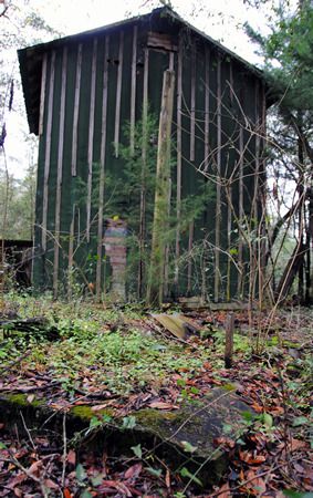
The directions I’d been given led me up a hill and to a trail entering a wooded area northeast of downtown High Springs, and while they weren’t too specific for once I reached said wooded area, I vaguely remembered being told that the area was marked off with caution tape. Shortly after entering the woods, I began to come across the remains of structures: foundations, collapsing remains of wooden walls, and concrete structures. Initially I thought I might have found the old springhouse… until I noticed the old tobacco barn behind it. That didn’t seem to fit what I was looking for. Additionally, I couldn’t find anything that resembled a spring – not even a trickle.

 photo ohs1_zpsh66cxbdv.jpg
Foundations of something

 photo ohs2_zps20rshbe0.jpg
More foundations; tobacco barn in the distance

 photo ohs3b_zps9vcretqi.jpg

 photo ohs3_zpsnbv4xlzx.jpg
Collapsing wooden structure

 photo ohs4_zps0fiqzutq.jpg
The tobacco drying barn told me I was looking in the wrong place.

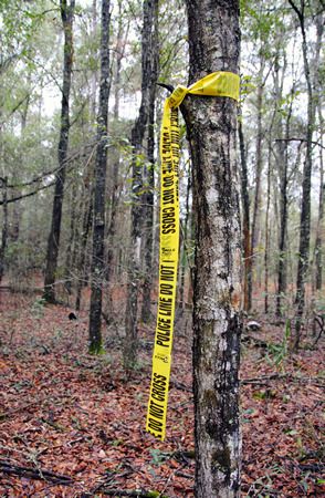
And so I continued on, following the trail until in the distance I saw what looked like yellow caution tape tied around a tree:

 photo ohs5_zpshmhwrz8a.jpg
Er. That’s caution tape, right?

Looking into the woods, I could see another band of yellow tape around another tree, and then farther into the woods, yet another. Following a Hansel and Gretel breadcrumb trail of police-line-do-not-cross tape into the forest all by your lonesome is surely a good idea. I figured either this was the caution tape that I thought I remembered hearing about, or I’d find myself arrested for trampling over a murder scene. As there hadn’t been any recent murders in the area (to my knowledge anyway), I figured I had to be on the right track. Safety first!

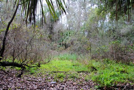
The pieces of yellow tape did indeed lead me to the spring – or what was left of it – and I would never have found it without them. When I finally reached the last piece of yellow tape in the trail, I could see what looked like a round clearing in the woods. It was impossible to get a photograph that showed what I could discern: a near perfect circle of slightly depressed land covered in weeds and small trees, surrounded by much older trees. Venturing into the depressed circle, I could tell that this had indeed once been the spring head pool. Around the edges older oaks leaned over what would have once been water. The ‘pool’ itself was nothing but mud – wet enough to show that water was still seeping to the surface, but dry(ish) enough to walk across, although my shoes definitely sunk into the mud in spots.

 photo ohs6_zpsnkpwqrii.jpg
What remains of what (probably) would have been the spring's pool

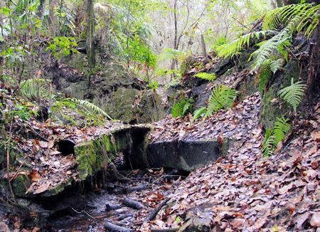
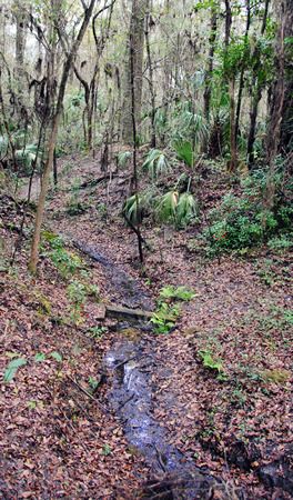
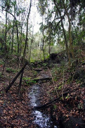
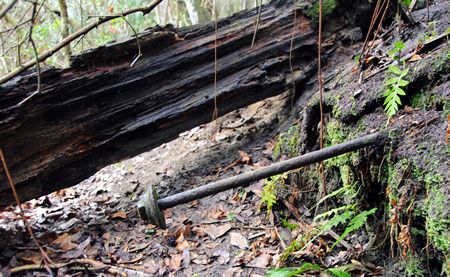
On one end of the former ‘pool’ the remains of a dam and pipe could be seen… and flowing through it and down an old creek bed was the trickle of water I had been told to expect.

 photo ohs10_zpsfcekmiuz.jpg
Remains of the dam. The round object in the lower left quadrant is a pipe.

 photo ohs7_zpsupnlmxgv.jpg
The stream, trickling east from the dam/pool

 photo ohs9_zpspntb6tre.jpg
Looking back towards the spring from downstream; the dam is at the top of the hill.

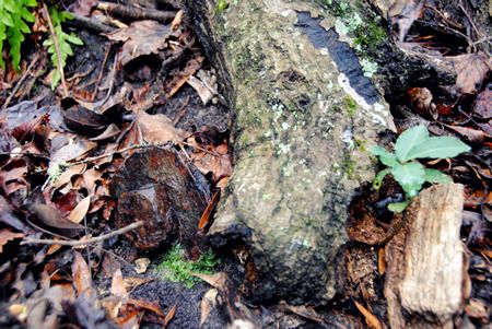
On the opposite side of the ‘pool’ I found three large metal bolts extending inward from the ‘pool’ wall. I've no idea what their purpose would have been.

 photo ohs13_zps8snqnrqr.jpg

 photo ohs14_zpsmo0nitjt.jpg

 photo ohs11_zpsc5pzr2e0.jpg

The complete set of photos taken on my explorations in search of the original High Springs Spring can be seen HERE.

According to the Alachua County Property Appraiser’s website, the piece of land upon which what remains of the spring sits belongs to the City of High Springs, which would certainly simplify the process of turning it into a city park. Of course, whether or not this actually comes to fruition definitely remains to be seen. And restoration of the spring itself? I do not know if such a thing would be possible, although if it were, that would indeed be lovely.

My continued obsession with the abandoned rail yards of High Springs

I was out for a ride on the unofficial rails-to-trails as I so often am, when I gave into temptation and decided to explore one of the pat...